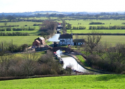
Caldon Canal
One of the most beautiful canals, accessible on a two week varied and rural trip.
Scroll down for details
We are currently running some special offers, Click here for more info
Christmas Opening Times
The office will be closed from the 20th December until the 5th January, but you can still book your holiday online
These route suggestions are offered in good faith and to the best of our knowledge. It is up to you to decide on your own stops and to ensure you return to the base at the agreed time.
we recommend you also check for current stoppages on the CRT website that may affect your choice of route
Caldon Canal
Napton Marina to Braunston
Points of Interest
Napton-on-the-Hill
Napton-on-the-hill, the home village of Napton Narrowboats.
Pictures: click for a bigger image

Location: On Google Maps
Best Access From: Bottom of the Napton Locks, Click for Route Map.
- Postcode: CV478HX
Points of Interest in Napton-on-the-Hill
The Kings Head Napton
The Kings Head is ideally situated on the A425 between Southam and Daventry.
It is just a 5 minute walk from Napton Narrowboats
Pub dining times
Mon to Thursday 12.00 noon to 2.00pm
Mon to Thurs - eve 6.00pm to10.00pm
Fri to Sat 12.00 noon to 10.00pm
Sunday 12.00 noon to 8.00pm
Reservations highly recommended. Please call 01926 812202.
Pictures: click for a bigger image

Location: On Google Maps
Best Access From: Bridge 109, Click for Route Map.
- Postcode: CV478NG
Napton Village Stores
Including a Post Office, and offering a range of local produce. Includes a cafe.
Napton Village Stores is owned and run by a local family, acquired in January 2014, offering a friendly welcome to local regulars and visitors to the village alike. The store itself had a complete refresh and the �Napton Kitchen� was introduced � a home from home place to enjoy a hot drink and a wealth of homemade foods to eat in or take away. Our deli fridge will tempt you daily and we also offer outside catering � we can bring the Napton Kitchen to your home or office.
Pictures: click for a bigger image

Location: On Google Maps
Best Access From: Folly Lane Bridge, Click for Route Map.
- Postcode: CV478LR
Napton Cidery
Craft Cider & Perry
Napton Cidery is an award-winning, family-run craft cidery based in Warwickshire. Buy our selection of naturally vegan & gluten-free ciders & perry online. Learn more about our unique cider tour & tasting experiences, around Warwickshire, Coventry & Birmingham.
Pictures: click for a bigger image

Location: On Google Maps
Best Access From: Bottom of Napton Locks, Click for Route Map.
- Postcode: CV478NY
The Folly Pub
The Folly Inn, Napton is a family and dog friendly, warm, local pub with excellent homemade food.
Pictures: click for a bigger image

Location: On Google Maps
Best Access From: Bottom of Napton Locks, Click for Route Map.
- Postcode: CV478NZ
Flecknoe
Small village between Napton and Braunston, location of the Old Olive Bush Pub
Location: On Google Maps
Best Access From: Bridge 101 or 102, Click for Route Map.
Points of Interest in Flecknoe
Old Olive Bush
Traditional Countryside Pub, just outside of Rugby. Serving delicious food, with a beautiful beer garden.
Pictures: click for a bigger image

Location: On Google Maps
Best Access From: Bridge 101 or 102, Click for Route Map.
- Postcode: CV238AT
Braunston
Lovely canalside village
Pictures: click for a bigger image

Location: On Google Maps
Best Access From: Canal Bridge, Click for Route Map.
Points of Interest in Braunston
The Boat House
The Boathouse pub & restaurant sits beside the Grand Union Canal. Dog Friendly.
Pictures: click for a bigger image

Location: On Google Maps
Best Access From: Bridge 91, Click for Route Map.
- Postcode: NN117HB
Admiral Nelson
The Admiral Nelson continues to provide rest & sustenance to canal users & villagers alike.
Pictures: click for a bigger image

Location: On Google Maps
Best Access From: Bridge 4, Click for Route Map.
- Postcode: NN117HJ
Old Plough Pub & Restaurant
One of two pubs in Braunston village itself.
Pictures: click for a bigger image

Location: On Google Maps
Best Access From: Bridge 1, Click for Route Map.
- Postcode: NN17HS
The Wheatsheaf
One of two pubs in Braunston village itself.
Location: On Google Maps
Best Access From: Bridge 1, Click for Route Map.
- Postcode: NN117HW
All Saints' Church, Braunston
Location: On Google Maps
Best Access From: Bridge 91, Click for Route Map.
Gongoozlers Rest
Moored on the Grand Union Canal just outside of Braunston Marina, we serve freshly cooked breakfasts, baguettes & sandwiches, homemade cakes and hot drinks.
Pictures: click for a bigger image

Location: On Google Maps
Best Access From: Canalside at Marina Entrance, Click for Route Map.
Braunston Village Stores & Post Office
Post Office & grocery stores with butcher selling Village Meats.
Location: On Google Maps
Best Access From: Bridge 1, Click for Route Map.
- Postcode: NN117HR
Braunston to Sutton Stop
Points of Interest
Hillmorton
Hillmorton is a suburb of Rugby, around 2 miles (3.2 km) south-east of Rugby town centre,
Location: On Google Maps
Best Access From: Hillmorton Locks, Click for Route Map.
Points of Interest in Hillmorton
The Waterside Pub & Carvery
Greene King Pub and Carvery canalside in Rugby. Dog friendly.
Location: On Google Maps
Best Access From: Bridge 73, Click for Route Map.
- Postcode: CV214PW
Canal Chef Cafe
Canalside Cafe
Location: On Google Maps
Best Access From: Bridge 71, Click for Route Map.
- Postcode: CV214PP
Rugby
A Market town in Eastern Warwickshire.
Location: On Google Maps
Best Access From: Brownsover Moorings, Click for Route Map.
Points of Interest in Rugby
The Lounge Kitchen & Bar
The Lounge is a cosy kitchen and bar in the heart of Clifton upon Dunsmore
Pictures: click for a bigger image

Location: On Google Maps
Best Access From: Bridge 66, Click for Route Map.
- Postcode: CV230EY
Bell & Barge
Canalside Harvester Pub & Restaurant
Pictures: click for a bigger image

Location: On Google Maps
Best Access From: Bridge 58, Click for Route Map.
- Postcode: CV211HL
Tesco - Rugby
Large supermarket
Location: On Google Maps
Best Access From: Bridge 58, Click for Route Map.
- Postcode: CV211RG
Marks & Spencer, Rugby
Supermarket on Elliott's Field Retail Park
Asda, Rugby
Large Supermarket in Rugby town centre, a mile and a quarter walk from the canal.
Location: On Google Maps
Best Access From: Bridge 58, Click for Route Map.
- Postcode: CV213EB
Newbold-on-Avon
A suburb of Rugby, about a mile and a half North West of the town
Pictures: click for a bigger image

Location: On Google Maps
Best Access From: Canalside just South of Newbold Tunnel, Click for Route Map.
Points of Interest in Newbold-on-Avon
Barley Mow, Newbold
Canalside pub
At the Barley Mow, you can choose where you prefer to drink and dine. This can be in the restaurant, snug, bar, games room, patio, gardens, playground or by the canal.
Pictures: click for a bigger image

Location: On Google Maps
Best Access From: Canalside just South of Newbold Tunnel, Click for Route Map.
- Postcode: CV211HW
Brinklow
About a mile from the canal lies the village of Brinklow. Handy for pubs & a small shop, it's most prominent feature is the Norman motte-and-bailey castle (Brinklow Castle, known locally as The Tump or the Big Hill), which is one of the largest and best preserved of its type in England
Pictures: click for a bigger image

Location: On Google Maps
Best Access From: Bridge 30, Click for Route Map.
Points of Interest in Brinklow
The Raven, Brinklow
A traditional village pub, with open fires, pub games and fantastic cask ales.
Pictures: click for a bigger image

Location: On Google Maps
Best Access From: Bridge 30, Click for Route Map.
- Postcode: CV230LN
White Lion, Brinklow
Friendly village local pub serving up home cooked food and real ales
Pictures: click for a bigger image

Location: On Google Maps
Best Access From: Bridge 30, Click for Route Map.
- Postcode: CV230LN
Brinklow Fish Bar
Traditional Fish and Chips Takeaway
Pictures: click for a bigger image

Location: On Google Maps
Best Access From: Bridge 30, Click for Route Map.
Ansty
Ansty is a small village about 5 miles (8 km) northeast of Coventry city centre. It has a Gastro Pub a and Golf Club which is open to none members
Location: On Google Maps
Best Access From: Bridge 14 or 16, Click for Route Map.
Points of Interest in Ansty
Rose & Castle, Ansty
Based on the outskirts of Coventry City, we pride ourselves on producing home cooked food by our team of chefs, everything from starters to desserts.
Pictures: click for a bigger image

Location: On Google Maps
Best Access From: Bridge 14 or 16, Click for Route Map.
- Postcode: CV79HZ
Hawkesbury Junction
Hawkesbury Junction (or Sutton Stop) is where the Oxford Canal meets the Coventry Canal. The alternative name, Sutton Stop, arises from the name of a family which provided several lock keepers there in the nineteenth century.
Pictures: click for a bigger image

Location: On Google Maps
Best Access From: Canalside, Click for Route Map.
Points of Interest in Hawkesbury Junction
The Greyhound
Canalside pub at Hawkesbury Junction
Pictures: click for a bigger image

Location: On Google Maps
Best Access From: Canalside, Click for Route Map.
- Postcode: CV66DF
Sutton Stop to Polesworth
Points of Interest
Nuneaton
A market town in Warwickshire, close to the county border with Leicestershire.
Useful for takeaways & shops
Location: On Google Maps
Best Access From: Wash Lane Bridge (21), Click for Route Map.
Points of Interest in Nuneaton
Sainsbury's Local, Nuneaton
Handy store for provisions, close to the canal
Location: On Google Maps
Best Access From: Wash Lane Bridge (21), Click for Route Map.
Wing Fat Chinese Takeaway
Location: On Google Maps
Best Access From: Wash Lane Bridge (21), Click for Route Map.
Pete's Fish & Chips
Pictures: click for a bigger image

Location: On Google Maps
Best Access From: Wash Lane Bridge (21), Click for Route Map.
Anchor Inn, Hartshill
Canalside Pub, Restaurant & Gardens. Family friendly with a huge children's play area.
Pictures: click for a bigger image

Location: On Google Maps
Best Access From: Anchor inn visitor moorings, Click for Route Map.
Atherstone
A market town in Northern Warwickshire, with its attendance shops & facilities. The Atherstone flight of locks pass through the town.
Location: On Google Maps
Best Access From: Above Atherstone Lock Flight, Click for Route Map.
Points of Interest in Atherstone
Atherstone Locks
A flight of 11 locks taking you up alongside the town of Atherstone
Location: On Google Maps
Best Access From: Atherston Bottom Lock, Click for Route Map.
Polesworth
A large village in Northern Warwickshire
Location: On Google Maps
Best Access From: Canalside moorings, Click for Route Map.
Points of Interest in Polesworth
Royal Oak, Polesworth
Friendly canal side pub offering a good choice of real ales and a selection of keg beers wines and spirits.
Pictures: click for a bigger image

Location: On Google Maps
Best Access From: Towpath moorings, Click for Route Map.
Red Lion, Polesworth
A friendly family run pub set on Bridge Street, Polesworth
Premier Convenience Store
A short walk from the canal, handy for stocking up on provisions.
Location: On Google Maps
Best Access From: Bridge 52, Click for Route Map.
Polesworth Fish Bar
Takeaway Fish and Chips, burgers, kebabs & pizzas.
Polesworth to Handsacre
Points of Interest
Fazeley Junction
Historic canal junction joining the Coventry and Birmingham & Fazeley canals. The town itself is convenient for a pub or shopping stop.
Location: On Google Maps
Best Access From: Visitor Moorings, Click for Route Map.
Points of Interest in Fazeley Junction
The Three Tuns pub, Fazeley Junction
Extensively refurbished in 2022, The Three Tuns is now one of the most popular pubs in the area! 40+ real ciders, real ales, craft beers and a canalside beer garden.
Pictures: click for a bigger image

Location: On Google Maps
Best Access From: Fazeley visitor moorings, Click for Route Map.
Tesco Express, Fazeley
A handy store to top up any needed provisions, just a short walk from the canal
Location: On Google Maps
Best Access From: Fazeley visitor moorings, Click for Route Map.
Fradley Junction
The junction of the Trent & Mersey Canal and the Coventry Canal.
Location: On Google Maps
Best Access From: The Canal, Click for Route Map.
Points of Interest in Fradley Junction
The Swan Pub, Fradley Junction
A wonderful 16th century grade 2 listed public house situated on the canal. With great outside space next to the canal.
Serving great food and a fab choice of drinks all year round.
Pictures: click for a bigger image

Location: On Google Maps
Best Access From: Canalside Moorings, Click for Route Map.
Handsacre
A small village in Staffordshire on the Trent and Mersey Canal
Location: On Google Maps
Best Access From: Bridge 56, Click for Route Map.
Points of Interest in Handsacre
The Crown Inn, Handsacre
Traditional pub, with a large beer garden overlooking the Trent & Mersey canal. Dog friendly, keeps 3 real ales & sell homemade Cobs.
Pictures: click for a bigger image

Location: On Google Maps
Best Access From: Bridge 56, Click for Route Map.
The Old Peculiar, Handsacre
A traditional, family run pub, in the Staffordshire village of Handsacre with Armitage. We offer all you would expect from a village Inn; Cask Marque accredited real ales and delicious homemade food.
Pictures: click for a bigger image

Location: On Google Maps
Best Access From: Bridge 56, Click for Route Map.
Michael's Fish Bar
Traditional Fish & Chips close to the canal
Handsacre to Stone
Points of Interest
Rugeley
A Market town in Staffordshire, this is a handy stop for provisions with both a Tesco Superstore and a Morrisons within walking distance of the canal. Various shops, pubs & takeaways are available in the town
Location: On Google Maps
Best Access From: Tan Yard Bridge (66), Click for Route Map.
Points of Interest in Rugeley
Tesco, Rugeley
Superstore within walking distance of the canal
Location: On Google Maps
Best Access From: Tan Yard Bridge (66), Click for Route Map.
Morrisons, Rugeley
Supermarket within walking distance of the canal
Location: On Google Maps
Best Access From: Tan Yard Bridge (66), Click for Route Map.
Rugeley Bicycle Repairs
A local bike shop offering Service, Sales, Repairs & Cycle Hire.
Location: On Google Maps
Best Access From: Tan Yard Bridge (66), Click for Route Map.
Great Haywood
The junction of the Trent & Mersey Canal and the Staffordshire & Worcestershire Canal
Location: On Google Maps
Best Access From: Trentlane Bridge (73), Click for Route Map.
Points of Interest in Great Haywood
Clifford Arms
We offer a fine selection of cask-conditioned ales and guest beers together with a wide choice of freshly prepared, value for money meals and snacks.
Pictures: click for a bigger image

Location: On Google Maps
Best Access From: Trentlane Bridge (73), Click for Route Map.
Shugborough Hall
A stately home and estate near Great Haywood, Staffordshire, England. Now owned by the National Trust and open to the public.
Pictures: click for a bigger image

Location: On Google Maps
Best Access From: Trentlane Bridge (73), Click for Route Map.
The Woolpack, Weston
The Woolpack in Weston is a traditional pub with all of the beautiful traditional pub characteristics, from oak beams and low ceilings to real fires and a cosy beer gardens
Pictures: click for a bigger image

Location: On Google Maps
Best Access From: Weston Bridge (80), Click for Route Map.
The Saracen's Head, Weston
Saracen's Head is a family and dog friendly, rustic, country pub located in the heart of Weston, Staffordshire.
Dogs are welcome in the garden and bar.
Takeaway also available - see website.
Pictures: click for a bigger image

Location: On Google Maps
Best Access From: Weston Bridge (80), Click for Route Map.
Stone
A market town in Staffordshire, Stone is a popular stop on the Trent & Mersey canal. The listed facilities are just a small selection of what's available here.
Location: On Google Maps
Points of Interest in Stone
The Star, Stone
Traditional pub right next to the star lock
Pictures: click for a bigger image

Location: On Google Maps
Best Access From: Canalside, Click for Route Map.
The Swan, Stone
A thriving freehouse in a carefully renovated Grade II listed building, close to the Trent & Mersey Canal. Eight hand pumps serve ever-changing beers. There's also real cider on draught. Strictly adults only, dog friendly, and the pub does not serve food.
Pictures: click for a bigger image

Location: On Google Maps
Best Access From: Bridge 93, Click for Route Map.
Priory Fish Bar
Fish & Chips shop
Morrisons, Stone
Supermarket a short walk from the canal
Location: On Google Maps
Best Access From: Bridge 93, Click for Route Map.
The Poste of Stone
Wetherspoon's Chain pub in the old post office
Pictures: click for a bigger image

Location: On Google Maps
Best Access From: Bridge 83, Click for Route Map.
Crown of India, Stone
Indian Restaurant and takeaway with online ordering
Handsacre
A small village in Staffordshire on the Trent and Mersey Canal
Location: On Google Maps
Best Access From: Bridge 56, Click for Route Map.
Points of Interest in Handsacre
The Crown Inn, Handsacre
Traditional pub, with a large beer garden overlooking the Trent & Mersey canal. Dog friendly, keeps 3 real ales & sell homemade Cobs.
Pictures: click for a bigger image
Location: On Google Maps
Best Access From: Bridge 56, Click for Route Map.
The Old Peculiar, Handsacre
A traditional, family run pub, in the Staffordshire village of Handsacre with Armitage. We offer all you would expect from a village Inn; Cask Marque accredited real ales and delicious homemade food.
Pictures: click for a bigger image
Location: On Google Maps
Best Access From: Bridge 56, Click for Route Map.
Michael's Fish Bar
Traditional Fish & Chips close to the canal
Stone to Stoke-on-Trent
Points of Interest
World Of Wedgwood
Home to Stoke-on-Trent's most prestigious brand, Wedgwood, and the galleries of the V&A Wedgwood Collection. Our multi-experience site houses our hands-on Creative Studios, Wedgwood Factory, Wedgwood Tea Room, and a diverse range of retail outlets, delicious eateries and bars.
Location: On Google Maps
Best Access From: Wedgwood visitor moorings, Click for Route Map.
Toby Carvery, Trentham
Timeless family chain restaurant serving roast meats carvery-style, kids' menus and classic puds.
Location: On Google Maps
Best Access From: Hemheath Bridge (106), Click for Route Map.
Sainsbury's, Stoke on Trent
Large supermarket 10 minutes walk from the canal
Location: On Google Maps
Best Access From: Towpath near Dolphin Boatyard, Click for Route Map.
The Holy Inadequate
Well regarded pub serving Real Ale. Delicious pork pies and scotch eggs are available all day along with other bar snacks.
Pictures: click for a bigger image

Location: On Google Maps
Best Access From: Etruria Trent & Mersey Canal Visitor Moorings with rings, Click for Route Map.
Stoke-on-Trent to Leek
Points of Interest
The Foxley Pub / Hotel
Friendly pub with the traditional two-roomed layout being separated by a central bar. There is a smoking area and garden with bench tables to the rear,
Pictures: click for a bigger image

Location: On Google Maps
Best Access From: Milton bridge (18), Click for Route Map.
The Millrace Pub
Tradition Marston's Pub. Dogs welcome on a lead. Beer garden
Location: On Google Maps
Best Access From: Milton bridge (18), Click for Route Map.
Co-op, Milton
Handy food supermarket
Location: On Google Maps
Best Access From: Milton bridge (18), Click for Route Map.
The Sportsman, Stockton Brook
Traditional pub in the heart of Stockton Brook.
Serving great ales and a fantastic selection of draught and bottled spirits
Pictures: click for a bigger image

Location: On Google Maps
Best Access From: Towpath Moorings, Click for Route Map.
Lockside at Greenway Hall
Restaurant serving good food, delicious drinks, and great company are the perfect ingredients for a memorable night out. We use only the freshest and highest-quality ingredients, sourced from local farms and producers, to create dishes that are both delicious and authentic.
Location: On Google Maps
Best Access From: Towpath Moorings, Click for Route Map.
Ego at the Hollybush
Freshly cooked Mediterranean food, cocktails and local cask ale, served with a smile at exceptional value, in a beautifully restored early 1900 pub
Location: On Google Maps
Best Access From: Towpath Moorings, Click for Route Map.
New Endon Stores
Handy convenience store and cashpoint a short walk from the canal.
Location: On Google Maps
Best Access From: Post Bridge (28), Click for Route Map.
Morrisons, Leek
Large supermarket, a 15 minute walk from the canal terminus at Leek. Turn at the last winding hole after Leek tunnel, and back up a few metres to a suitable towpath mooring.
Location: On Google Maps
Best Access From: Canal Towpath, Click for Route Map.
Leek to Cheddleton via Froghall
Points of Interest
Ego at the Hollybush
Freshly cooked Mediterranean food, cocktails and local cask ale, served with a smile at exceptional value, in a beautifully restored early 1900 pub
Location: On Google Maps
Best Access From: Towpath Moorings, Click for Route Map.
Cheddleton
A small village in the Staffordshire Moorlands.
Location: On Google Maps
Best Access From: Cheddleton Bridge (42), Click for Route Map.
Points of Interest in Cheddleton
Red Lion, Cheddleton
Great Village Pub Serving fantastic pub food.
Pictures: click for a bigger image

Location: On Google Maps
Best Access From: Cheddleton Bridge (42), Click for Route Map.
The Black Lion, Cheddleton
A traditional & homely country pub offering a great selection of real ales,wines & proper pub food!
Pictures: click for a bigger image

Location: On Google Maps
Best Access From: Cheddleton Bridge (42), Click for Route Map.
The Flintlock at Cheddleton
Local food in the heart of
the Staffordshire Moorlands. The Flintlock is an informal fine dining restaurant with a large lounge area.
Pictures: click for a bigger image

Location: On Google Maps
Best Access From: Canal Towpath, Click for Route Map.
One Stop Stores
Mini-market chain, open every day for groceries, alcoholic beverages & newspapers.
Location: On Google Maps
Best Access From: Cheddleton Bridge (42), Click for Route Map.
The Avenue Fish Bar
Takeaway Fish and Chips
Location: On Google Maps
Best Access From: Cheddleton Bridge (42), Click for Route Map.
The Boat Inn, Cheddleton
Beautiful canal side Marston's pub that offers a warm, friendly service and a lovely atmosphere!
Pictures: click for a bigger image

Location: On Google Maps
Best Access From: Basford Bridge (44), Click for Route Map.
Cheddleton Flint Mill
Rural mill complex dating back to the Middle Ages featuring 2 water wheels, a cottage & a museum. The mill race takes water from the river Churnet.
Cheddleton Flint Mill can be visited all year round and is not subject to specific opening hours.
Interior access to the various buildings is only possible on days supported by volunteers.
Volunteer days are Mondays and Wednesdays, from 10:00 to 16:00.
Pictures: click for a bigger image

Location: On Google Maps
Best Access From: Cheddleton Bridge (42), Click for Route Map.
The Black Lion, Consall Forge
Nestled snuggly in the heart of Churnet Valley lies the Black Lion Pub, a fine example of Staffordshire tradition. Offering a superb range of award winning ales and ciders. A real delight to discover!
Pictures: click for a bigger image

Location: On Google Maps
Best Access From: Colsall Forge Moorings, Click for Route Map.
Churnett Valley Railway (Consall Station)
A heritage Railway offering nostalgic steam train rides through the Staffordshire Moorlands, meandering through the hidden beauty of the Churnet Valley, just a stone's throw from the enchanting outskirts of the Peak District
Pictures: click for a bigger image

Location: On Google Maps
Best Access From: London Bridge (50B), Click for Route Map.
Froghall Winding Hole and Tunnel
We recommend turning at the winding hole just before Froghall tunnel, since headroom is very restricted and the canal only extends a further 300m anyway before the terminus is reached.
Feel free to moor and walk over the top if you want to see the end of the line, before heading back the way you came to stop the night in Cheddleton
Location: On Google Maps
Cheddleton to Stoke-on-Trent
Points of Interest
New Endon Stores
Handy convenience store and cashpoint a short walk from the canal.
Location: On Google Maps
Best Access From: Post Bridge (28), Click for Route Map.
Ego at the Hollybush
Freshly cooked Mediterranean food, cocktails and local cask ale, served with a smile at exceptional value, in a beautifully restored early 1900 pub
Location: On Google Maps
Best Access From: Towpath Moorings, Click for Route Map.
Lockside at Greenway Hall
Restaurant serving good food, delicious drinks, and great company are the perfect ingredients for a memorable night out. We use only the freshest and highest-quality ingredients, sourced from local farms and producers, to create dishes that are both delicious and authentic.
Location: On Google Maps
Best Access From: Towpath Moorings, Click for Route Map.
The Sportsman, Stockton Brook
Traditional pub in the heart of Stockton Brook.
Serving great ales and a fantastic selection of draught and bottled spirits
Pictures: click for a bigger image
Location: On Google Maps
Best Access From: Towpath Moorings, Click for Route Map.
Co-op, Milton
Handy food supermarket
Location: On Google Maps
Best Access From: Milton bridge (18), Click for Route Map.
The Millrace Pub
Tradition Marston's Pub. Dogs welcome on a lead. Beer garden
Location: On Google Maps
Best Access From: Milton bridge (18), Click for Route Map.
The Foxley Pub / Hotel
Friendly pub with the traditional two-roomed layout being separated by a central bar. There is a smoking area and garden with bench tables to the rear,
Pictures: click for a bigger image
Location: On Google Maps
Best Access From: Milton bridge (18), Click for Route Map.
The Holy Inadequate
Well regarded pub serving Real Ale. Delicious pork pies and scotch eggs are available all day along with other bar snacks.
Pictures: click for a bigger image
Location: On Google Maps
Best Access From: Etruria Trent & Mersey Canal Visitor Moorings with rings, Click for Route Map.
Toby Carvery, Festival Park
Timeless family chain restaurant serving roast meats carvery-style, kids' menus and classic puds.
Location: On Google Maps
Best Access From: Adjacent moorings, Click for Route Map.
Stoke-on-Trent to Weston
Points of Interest
Sainsbury's, Stoke on Trent
Large supermarket 10 minutes walk from the canal
Location: On Google Maps
Best Access From: Towpath near Dolphin Boatyard, Click for Route Map.
Toby Carvery, Trentham
Timeless family chain restaurant serving roast meats carvery-style, kids' menus and classic puds.
Location: On Google Maps
Best Access From: Hemheath Bridge (106), Click for Route Map.
World Of Wedgwood
Home to Stoke-on-Trent's most prestigious brand, Wedgwood, and the galleries of the V&A Wedgwood Collection. Our multi-experience site houses our hands-on Creative Studios, Wedgwood Factory, Wedgwood Tea Room, and a diverse range of retail outlets, delicious eateries and bars.
Location: On Google Maps
Best Access From: Wedgwood visitor moorings, Click for Route Map.
Stone
A market town in Staffordshire, Stone is a popular stop on the Trent & Mersey canal. The listed facilities are just a small selection of what's available here.
Location: On Google Maps
Points of Interest in Stone
The Star, Stone
Traditional pub right next to the star lock
Pictures: click for a bigger image
Location: On Google Maps
Best Access From: Canalside, Click for Route Map.
The Swan, Stone
A thriving freehouse in a carefully renovated Grade II listed building, close to the Trent & Mersey Canal. Eight hand pumps serve ever-changing beers. There's also real cider on draught. Strictly adults only, dog friendly, and the pub does not serve food.
Pictures: click for a bigger image
Location: On Google Maps
Best Access From: Bridge 93, Click for Route Map.
Priory Fish Bar
Fish & Chips shop
Morrisons, Stone
Supermarket a short walk from the canal
Location: On Google Maps
Best Access From: Bridge 93, Click for Route Map.
The Poste of Stone
Wetherspoon's Chain pub in the old post office
Pictures: click for a bigger image
Location: On Google Maps
Best Access From: Bridge 83, Click for Route Map.
Crown of India, Stone
Indian Restaurant and takeaway with online ordering
The Saracen's Head, Weston
Saracen's Head is a family and dog friendly, rustic, country pub located in the heart of Weston, Staffordshire.
Dogs are welcome in the garden and bar.
Takeaway also available - see website.
Pictures: click for a bigger image
Location: On Google Maps
Best Access From: Weston Bridge (80), Click for Route Map.
The Woolpack, Weston
The Woolpack in Weston is a traditional pub with all of the beautiful traditional pub characteristics, from oak beams and low ceilings to real fires and a cosy beer gardens
Pictures: click for a bigger image
Location: On Google Maps
Best Access From: Weston Bridge (80), Click for Route Map.
Weston to Fradley Junction
Points of Interest
Great Haywood
The junction of the Trent & Mersey Canal and the Staffordshire & Worcestershire Canal
Location: On Google Maps
Best Access From: Trentlane Bridge (73), Click for Route Map.
Points of Interest in Great Haywood
Clifford Arms
We offer a fine selection of cask-conditioned ales and guest beers together with a wide choice of freshly prepared, value for money meals and snacks.
Pictures: click for a bigger image
Location: On Google Maps
Best Access From: Trentlane Bridge (73), Click for Route Map.
Shugborough Hall
A stately home and estate near Great Haywood, Staffordshire, England. Now owned by the National Trust and open to the public.
Pictures: click for a bigger image
Location: On Google Maps
Best Access From: Trentlane Bridge (73), Click for Route Map.
Rugeley
A Market town in Staffordshire, this is a handy stop for provisions with both a Tesco Superstore and a Morrisons within walking distance of the canal. Various shops, pubs & takeaways are available in the town
Location: On Google Maps
Best Access From: Tan Yard Bridge (66), Click for Route Map.
Points of Interest in Rugeley
Tesco, Rugeley
Superstore within walking distance of the canal
Location: On Google Maps
Best Access From: Tan Yard Bridge (66), Click for Route Map.
Morrisons, Rugeley
Supermarket within walking distance of the canal
Location: On Google Maps
Best Access From: Tan Yard Bridge (66), Click for Route Map.
Rugeley Bicycle Repairs
A local bike shop offering Service, Sales, Repairs & Cycle Hire.
Location: On Google Maps
Best Access From: Tan Yard Bridge (66), Click for Route Map.
Fradley Junction
The junction of the Trent & Mersey Canal and the Coventry Canal.
Location: On Google Maps
Best Access From: The Canal, Click for Route Map.
Points of Interest in Fradley Junction
The Swan Pub, Fradley Junction
A wonderful 16th century grade 2 listed public house situated on the canal. With great outside space next to the canal.
Serving great food and a fab choice of drinks all year round.
Pictures: click for a bigger image
Location: On Google Maps
Best Access From: Canalside Moorings, Click for Route Map.
Fradley Junction to Polesworth
Points of Interest
Fazeley Junction
Historic canal junction joining the Coventry and Birmingham & Fazeley canals. The town itself is convenient for a pub or shopping stop.
Location: On Google Maps
Best Access From: Visitor Moorings, Click for Route Map.
Points of Interest in Fazeley Junction
The Three Tuns pub, Fazeley Junction
Extensively refurbished in 2022, The Three Tuns is now one of the most popular pubs in the area! 40+ real ciders, real ales, craft beers and a canalside beer garden.
Pictures: click for a bigger image
Location: On Google Maps
Best Access From: Fazeley visitor moorings, Click for Route Map.
Tesco Express, Fazeley
A handy store to top up any needed provisions, just a short walk from the canal
Location: On Google Maps
Best Access From: Fazeley visitor moorings, Click for Route Map.
Polesworth
A large village in Northern Warwickshire
Location: On Google Maps
Best Access From: Canalside moorings, Click for Route Map.
Points of Interest in Polesworth
Royal Oak, Polesworth
Friendly canal side pub offering a good choice of real ales and a selection of keg beers wines and spirits.
Pictures: click for a bigger image
Location: On Google Maps
Best Access From: Towpath moorings, Click for Route Map.
Red Lion, Polesworth
A friendly family run pub set on Bridge Street, Polesworth
Premier Convenience Store
A short walk from the canal, handy for stocking up on provisions.
Location: On Google Maps
Best Access From: Bridge 52, Click for Route Map.
Polesworth Fish Bar
Takeaway Fish and Chips, burgers, kebabs & pizzas.
Polesworth to Sutton Stop / Ansty
Points of Interest
Atherstone
A market town in Northern Warwickshire, with its attendance shops & facilities. The Atherstone flight of locks pass through the town.
Location: On Google Maps
Best Access From: Above Atherstone Lock Flight, Click for Route Map.
Points of Interest in Atherstone
Atherstone Locks
A flight of 11 locks taking you up alongside the town of Atherstone
Location: On Google Maps
Best Access From: Atherston Bottom Lock, Click for Route Map.
Anchor Inn, Hartshill
Canalside Pub, Restaurant & Gardens. Family friendly with a huge children's play area.
Pictures: click for a bigger image
Location: On Google Maps
Best Access From: Anchor inn visitor moorings, Click for Route Map.
Nuneaton
A market town in Warwickshire, close to the county border with Leicestershire.
Useful for takeaways & shops
Location: On Google Maps
Best Access From: Wash Lane Bridge (21), Click for Route Map.
Points of Interest in Nuneaton
Sainsbury's Local, Nuneaton
Handy store for provisions, close to the canal
Location: On Google Maps
Best Access From: Wash Lane Bridge (21), Click for Route Map.
Wing Fat Chinese Takeaway
Location: On Google Maps
Best Access From: Wash Lane Bridge (21), Click for Route Map.
Pete's Fish & Chips
Pictures: click for a bigger image
Location: On Google Maps
Best Access From: Wash Lane Bridge (21), Click for Route Map.
Hawkesbury Junction
Hawkesbury Junction (or Sutton Stop) is where the Oxford Canal meets the Coventry Canal. The alternative name, Sutton Stop, arises from the name of a family which provided several lock keepers there in the nineteenth century.
Pictures: click for a bigger image
Location: On Google Maps
Best Access From: Canalside, Click for Route Map.
Points of Interest in Hawkesbury Junction
The Greyhound
Canalside pub at Hawkesbury Junction
Pictures: click for a bigger image
Location: On Google Maps
Best Access From: Canalside, Click for Route Map.
- Postcode: CV66DF
Ansty
Ansty is a small village about 5 miles (8 km) northeast of Coventry city centre. It has a Gastro Pub a and Golf Club which is open to none members
Location: On Google Maps
Best Access From: Bridge 14 or 16, Click for Route Map.
Points of Interest in Ansty
Rose & Castle, Ansty
Based on the outskirts of Coventry City, we pride ourselves on producing home cooked food by our team of chefs, everything from starters to desserts.
Pictures: click for a bigger image
Location: On Google Maps
Best Access From: Bridge 14 or 16, Click for Route Map.
- Postcode: CV79HZ
Sutton Stop / Ansty to Flecknoe
Points of Interest
Brinklow
About a mile from the canal lies the village of Brinklow. Handy for pubs & a small shop, it's most prominent feature is the Norman motte-and-bailey castle (Brinklow Castle, known locally as The Tump or the Big Hill), which is one of the largest and best preserved of its type in England
Pictures: click for a bigger image
Location: On Google Maps
Best Access From: Bridge 30, Click for Route Map.
Points of Interest in Brinklow
The Raven, Brinklow
A traditional village pub, with open fires, pub games and fantastic cask ales.
Pictures: click for a bigger image
Location: On Google Maps
Best Access From: Bridge 30, Click for Route Map.
- Postcode: CV230LN
White Lion, Brinklow
Friendly village local pub serving up home cooked food and real ales
Pictures: click for a bigger image
Location: On Google Maps
Best Access From: Bridge 30, Click for Route Map.
- Postcode: CV230LN
Brinklow Fish Bar
Traditional Fish and Chips Takeaway
Pictures: click for a bigger image
Location: On Google Maps
Best Access From: Bridge 30, Click for Route Map.
Newbold-on-Avon
A suburb of Rugby, about a mile and a half North West of the town
Pictures: click for a bigger image
Location: On Google Maps
Best Access From: Canalside just South of Newbold Tunnel, Click for Route Map.
Points of Interest in Newbold-on-Avon
Barley Mow, Newbold
Canalside pub
At the Barley Mow, you can choose where you prefer to drink and dine. This can be in the restaurant, snug, bar, games room, patio, gardens, playground or by the canal.
Pictures: click for a bigger image
Location: On Google Maps
Best Access From: Canalside just South of Newbold Tunnel, Click for Route Map.
- Postcode: CV211HW
Rugby
A Market town in Eastern Warwickshire.
Location: On Google Maps
Best Access From: Brownsover Moorings, Click for Route Map.
Points of Interest in Rugby
The Lounge Kitchen & Bar
The Lounge is a cosy kitchen and bar in the heart of Clifton upon Dunsmore
Pictures: click for a bigger image
Location: On Google Maps
Best Access From: Bridge 66, Click for Route Map.
- Postcode: CV230EY
Bell & Barge
Canalside Harvester Pub & Restaurant
Pictures: click for a bigger image
Location: On Google Maps
Best Access From: Bridge 58, Click for Route Map.
- Postcode: CV211HL
Tesco - Rugby
Large supermarket
Location: On Google Maps
Best Access From: Bridge 58, Click for Route Map.
- Postcode: CV211RG
Marks & Spencer, Rugby
Supermarket on Elliott's Field Retail Park
Asda, Rugby
Large Supermarket in Rugby town centre, a mile and a quarter walk from the canal.
Location: On Google Maps
Best Access From: Bridge 58, Click for Route Map.
- Postcode: CV213EB
Hillmorton
Hillmorton is a suburb of Rugby, around 2 miles (3.2 km) south-east of Rugby town centre,
Location: On Google Maps
Best Access From: Hillmorton Locks, Click for Route Map.
Points of Interest in Hillmorton
The Waterside Pub & Carvery
Greene King Pub and Carvery canalside in Rugby. Dog friendly.
Location: On Google Maps
Best Access From: Bridge 73, Click for Route Map.
- Postcode: CV214PW
Canal Chef Cafe
Canalside Cafe
Location: On Google Maps
Best Access From: Bridge 71, Click for Route Map.
- Postcode: CV214PP
Braunston
Lovely canalside village
Pictures: click for a bigger image
Location: On Google Maps
Best Access From: Canal Bridge, Click for Route Map.
Points of Interest in Braunston
The Boat House
The Boathouse pub & restaurant sits beside the Grand Union Canal. Dog Friendly.
Pictures: click for a bigger image
Location: On Google Maps
Best Access From: Bridge 91, Click for Route Map.
- Postcode: NN117HB
Admiral Nelson
The Admiral Nelson continues to provide rest & sustenance to canal users & villagers alike.
Pictures: click for a bigger image
Location: On Google Maps
Best Access From: Bridge 4, Click for Route Map.
- Postcode: NN117HJ
Old Plough Pub & Restaurant
One of two pubs in Braunston village itself.
Pictures: click for a bigger image
Location: On Google Maps
Best Access From: Bridge 1, Click for Route Map.
- Postcode: NN17HS
The Wheatsheaf
One of two pubs in Braunston village itself.
Location: On Google Maps
Best Access From: Bridge 1, Click for Route Map.
- Postcode: NN117HW
All Saints' Church, Braunston
Location: On Google Maps
Best Access From: Bridge 91, Click for Route Map.
Gongoozlers Rest
Moored on the Grand Union Canal just outside of Braunston Marina, we serve freshly cooked breakfasts, baguettes & sandwiches, homemade cakes and hot drinks.
Pictures: click for a bigger image
Location: On Google Maps
Best Access From: Canalside at Marina Entrance, Click for Route Map.
Braunston Village Stores & Post Office
Post Office & grocery stores with butcher selling Village Meats.
Location: On Google Maps
Best Access From: Bridge 1, Click for Route Map.
- Postcode: NN117HR
Flecknoe
Small village between Napton and Braunston, location of the Old Olive Bush Pub
Location: On Google Maps
Best Access From: Bridge 101 or 102, Click for Route Map.
Points of Interest in Flecknoe
Old Olive Bush
Traditional Countryside Pub, just outside of Rugby. Serving delicious food, with a beautiful beer garden.
Pictures: click for a bigger image
Location: On Google Maps
Best Access From: Bridge 101 or 102, Click for Route Map.
- Postcode: CV238AT
Flecknoe to Napton Marina
Guidebooks / Maps

Pearson's Guide: Four Counties Ring Companion
This Companion is the 9th edition of the perennially popular Four Counties Ring cruising circuit, but additionally features the whole of the Trent & Mersey Canal, the beautiful Caldon Canal and for the first time in this guide the curiously overlooked Weaver Navigation.

Pearson's Guide: South Midlands Companion
With the Warwickshire Ring at its heart, this Canal Companion covers the canal network to the south and east of Birmingham. Routes covered include: Grand Union Canal (Braunston-Birmingham); Birmingham & Fazeley Canal; Coventry Canal; Oxford Canal (Hawkesbury-Napton; Ashby Canal; Worcester & Birmingham Canal (Tardebigge-Birmingham); Trent & Mersey Canal (Derwent Mouth-Fradley) and Stratford upon Avon Canal.
Contact Us
- Phone:
- +44 (0)1926 813644 (Calls may be recorded for monitoring purposes)
- Email:
- enquiries@napton-marina.co.uk
- Open:
- November to March - 8:30am to 5:00pm (GMT) - Monday to Friday.